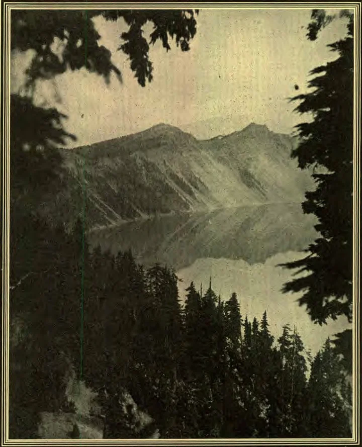
CRATER LAKE
By J. Edgar Ross
How to See It
By far the greater number of those who visit Crater Lake come from within a hundred miles in the surrounding country; for the lake is practically inaccessible during nine months of the year, and too far from the regular lines of travel to attract any considerable number of tourists during the remaining three. The majority of those who do visit the lake, drive up to the grassy plateau, where they eat their lunch, and spend a few hours admiring the placid blue waters, or climbing down the steep and winding trail to the water’s edge, to inscribe their names upon the rocks. Then they go away, thinking they have seen Crater Lake. And so they have—in a way. But that is not the best way.
If you would see Crater Lake so as to be able to appreciate its vastness, and know its rugged grandeur, you must take at least a week to it. Pitch your camp in a clump of hemlocks at the edge of the plateau, where you can see the glories of the sunrise across the serrated summit of Castle Crest, and watch the ever-changing light and shadow upon the calm, ultramarine waters of the lake. Climb down to the water’s edge, and build a raft of the scattered driftwood that you will find along the beach. With this you can paddle out to Wizzard Island, where a climb of eight hundred and fifty feet up its walls of broken pumice will bring you to the Witches’ Caldron,—the crater that saw the last of Mt. Mazama’s volcanic activity.
Another day might be spent in paddling along the southeastern shore, past the Phantom Ship, to Grotto Cove,—a diminutive bay on the eastern shore of the lake, where two little grottoes are found at the level of the water. If one can take a boat, or has the time and muscle to paddle a raft, the entire circuit of the lake ought by all means to be made. It is only about twenty miles, and in this way the topography of the lake can be studied as in no other.
The circuit of the lake can also be made by land, and in this trip one will come to many points that are not only deeply interesting in themselves, but afford an excellent view of the surrounding country. There is no trail around the lake, but I have been told that by keeping well down the mountain on the southeast andp. 162 southwest, the trip can be made with pack-horses in four days. A good climber, with a light pack, can easily make the circuit in three days, and need seldom be out of sight of the lake.
The climb up Castle Crest is not so difficult as it looks, and the summit of the rock affords a splendid view to the south. In the near foreground stands Union Peak, the remains of an extinct volcano, once much larger than at present, though it still has an altitude of about eight thousand feet. In early days it was used by the Rogue River Indians for a watch-tower, as a parapet of stone piled upon its small, flat top still bears witness. Beyond lies Mt. Pitt, a snow-capped peak, with an altitude of a little less than ten thousand feet. To the left lies Klamath Lake; and beyond that, in the dim and hazy distance, looms up the grim old giant, Mt. Shasta.
The eminence lying next to Castle Crest is Vidae Peak. This has an altitude of eight thousand two hundred feet, the highest point of Mt. Mazama, and towers two thousand feet above the water of the lake. Descending the east side of Vidae Peak, one comes to the deep, U-shaped cañon of Sun Creek. This is very hard to cross; but if you are interested in the study of geology, you will there find quite enough to repay you for the difficulties of the way. This cañon, as well as the one of Sand Creek, which lies some distance farther east, is the bed of one of Mt. Mazama’s ancient glaciers, and it still bears unmistakable evidence of its glacial origin. Beyond Sand Creek cañon the trip is a comparatively easy one. There will be no climbing to speak of until Llao Rock is reached, unless one chooses to make a detour of a few miles to climb Mt. Scott. This is a volcanic mound composed principally of loose, sliding pumice, supporting very little vegetation. It lies about two miles southeast of the lake; and as it is only about a thousand feet higher than Vidae Peak, I did not think it worth the climb.
Llao Rock affords another splendid view of sparkling lakes and grassy meadows, pumice deserts and wooded valleys, rugged peaks and deep-cut cañons. The most striking of these is Mt. Thielsen, whose sharp, needle-like point rises to an altitude of nine thousand two hundred and fifty feet. Mt. Thielsen is called “The Lightning-rod of the Cascades,” because of the fulgurite found upon its summit. Its ascent is said to be both difficult and dangerous, and possible from only one point.
The first few days of my stay the weather was delightful. Before I had finished the circuit of the lake, however, it turned cold and windy. I was very tired when I returned to camp, and would have been glad of a few days’ rest; but I suffered so much from cold that night that I decided to leave the following morning.
When my wheel was packed, I went out again to Victor Point to take a last look at the lake. The cold wind was blowing furiously, and lashing the beautiful blue waters into foam-crested billows, that chased one another across the surface of the lake. Vastly different was its appearance from what I had seen at first, when the water was as smooth as a polished mirror. The scene was so impressive that I could not help taking off my hat, and thanking God for permitting me to visit a spot so beautiful and grand.
J. EDGAR ROSS.