Lesson XI
NOTE TO TEACHERS.—This lesson is only suggestive, and several lessons should be given on making maps. Have the pupil make a map of his father's farm or lot. Take the children to a creek, and help them make a map of a portion of it, with its surroundings. Give enough work to insure the pupils' understanding what a map is, and what it is for. Sometimes it is helpful to get a plot of the neighborhood, and study it with the class.
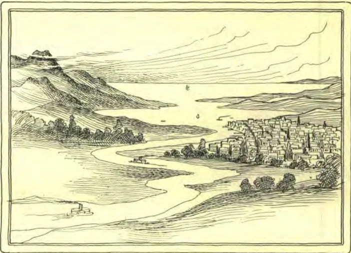
Before studying further, we will need to learn what maps are. No doubt you have seen them many times. Now you will like to learn what they are for, and how to use them. Here is a picture of a schoolhouse, taken from a distance, so that the playgrounds may be seen too. Then here is a representation of the same schoolhouse and playgrounds. You can see the difference,—the picture looks like a schoolhouse, while the map simply shows where it is, and where the other things on the grounds are.
In the next picture are some mountains, a sea, a bay, a river, and a town. Then again, we have these represented on a map, which merely gives the outlines, but is not a picture.
We may have a map of all the world, or of only a part of it. One can look at as many pictures as he pleases, and not know where the places are, but with a map, he can tell just where any place is on the earth.
We can not make a map as large as a place, so we adopt a scale to make the map by, so that everything will be in the right place. To illustrate this, make a map of your school-room. First, measure the size of the room. Suppose the room is 24 feet wide and 36 feet long. Draw the map 4 inches wide by 6 inches long. This would be one inch to each six feet, which is the scale. If you were making a map of a place, you might have the scale one inch to 10 miles, or one inch to 500 miles, or any other distance. As all maps are not the same size, and do not represent the same amount of land, the scale is put on the map, usually in the lower right-hand corner, and is marked as is shown in map No. 2.
Most maps are drawn so that the top is north and the bottom is south, the right side east and the left side west. A person can take a map and a compass, and go anywhere in the world, and know just where he is, if he keeps a record of how far he has gone.
You have seen globes, and know that they are spheres on which maps of the world are placed.
REVIEW.—What is a map? What is it for? Why would not a picture do as well? What is a scale? Where is it placed? Show how it is used by drawing a map of some place. What are the usual directions on a map? What is a globe?
FLOYD BRALLIAR.