The city of Sault Ste. Marie, the oldest settlement in the State of Michigan, is situated on the St. Mary's River, between Lake Superior and Lake Huron. Jesuit explorers visited it in the summer of 1615, under Pere Joseph Le Caron, and still others in 1623, when missionary operations were begun. In June, 1641, a company composed of representatives of the church and of the government of Louis XIV, together with fourteen Indian chiefs, took possession of the Sault de Ste. Marie and all the surrounding country, under the French flag. The place was then known, and is still in the Indian language, as Pau-Wau-Ting.
During the early Indian wars the Sault became a strategic point on account of its growing trade in furs. The French monopolized the trade until the spring of 1761, when the whole Northwest passed under British control. This lasted until, by the Treaty of Ghent, in 1814, the territory was ceded to the Americans.
Situated, as it is, in close proximity to the Great Lakes, the settlement soon became an important fur-trading station. Governor Mason, in 1837, recognized the commercial possibilities of the place; and in order to overcome a fall of twenty feet from Lake Superior to St. Mary's River, called the attention of the legislature to the importance of building a ship canal. He accordingly approved of an act to appropriate twenty-five thousand dollars for this purpose in the same year. Surveys were made, and a plan for two locks was agreed upon, which were to be of the following dimensions: width of canal, 75 feet; depth, 10 feet; width of locks, 32 feet; length, 100 feet; depth, 10 feet. The estimated cost was $112,544.
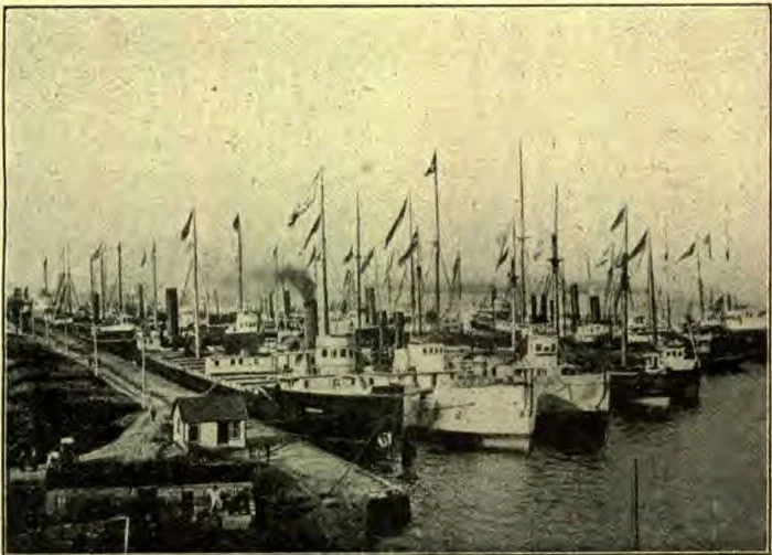
BLOCKADE — WAITING FOR NAVIGATION TO OPEN
In May, 1839, the work of surveying was begun, but was brought to a sudden standstill by Lieutenant Rood, post-commander at Fort Brady, because the surveys were made through the military reservation. For fifteen years it remained untouched, during which time prominent men of the Upper Peninsula labored arduously to obtain aid from Congress. On August 26, 1852, a bill was approved, in which seven hundred and fifty thousand acres of land were appropriated to aid the State of Michigan in carrying on the enterprise, and in June, 1853, ground was broken for the canal. The writer is indebted to Mr. Chase S. Osborn, State Commissioner of Railroads, for the following important data concerning the locks:—
“The locks were made three hundred and fifty feet long, with thirteen feet depth of water. The actual cost of the canal and locks was $999,802.46. April 19, 1855, water was first let into the canal, and June 18 the first boat was locked through. These locks have now been replaced with one great lift, known as the Poe Lock. Work was begun on the construction of this lock in April, 1889, and the completed lock was placed in operation in midsummer of 1894. The cost of construction was nearly five million dollars.”
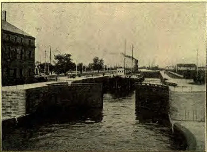
LOCKING A FIVE-HUNDRED-FOOT BOAT THROUGH THE POE
“October 20, 1870, the contract was let by the general government for the Weitzel Lock. This lock was completed and opened to navigation in 1881, at a cost of $2,405,000. The length of the canal is seven thousand feet. Its width is variable the least width being one hundred and eight feet at the point opposite the movable dam. The depth of the water when Lake Superior is at its average height, is sixteen feet. The chamber of this lock is five hundred and fifteen feet long, eighty feet wide, narrowed to sixty feet at the gates. The depth is thirty-nine and one-half feet. Its capacity is one million five hundred thousand cubic feet. The lift of the lock is eighteen feet; the depth of water on the miter-sills is seventeen feet. A guard gate is placed at each end of the chamber, making the length of the walls seven hundred and seventeen feet.”
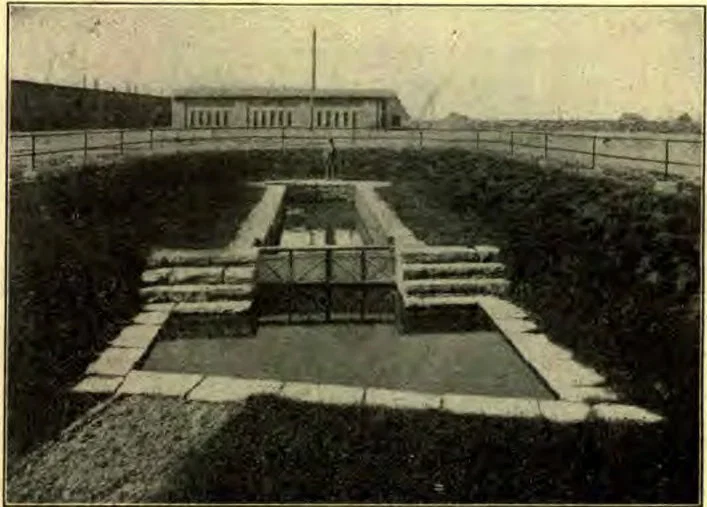
RUIN OF THE OLD CANADIAN LOCK
“There are 34,207 cubic yards of masonry, in the construction of which about thirty-five thousand barrels of cement were used, every barrel being tested. The water is let into the lock from culverts under the floor. The time consumed in emptying or filling the lock is about seven minutes.”
Every vessel passing through the locks is required to register the amount of tonnage. Stationed down the river some distance from the locks is an official whose business it is to watch for vessels coming upstream. Upon a vessel's approaching near enough for him to read the name with the aid of a field-glass, he steps to his telephone, calls up the power-house, gives the name of the vessel and the amount of tonnage, and asks to which lock he shall send it. Then through a trumpet he shouts to the pilot which lock to take. He is kept constantly busy sighting boats and passing them up-stream. The force at the locks is divided into three eight-hour shifts, who go on duty at 6 A. M., 2 P. M., and 10 P. M., respectively.
The “Soo” canal has been called the “world's greatest waterway” from the fact that more traffic is carried on here than upon any other water route in the world, the Suez Canal not excepted. During the seven months of navigation at the Soo, three times as much freight passes through the locks as at the Suez Canal for a whole year. In 1899 over 25,000,000 tons net of freight passed the Soo locks, valued at $281,000,000. In 1901 the tonnage amounted to 31,000,000 tons. It is expected that that of 1902 will reach 35,000,000 tons.
To be able to appreciate fully the vast amount of traffic carried on at the canal, one must see the mammoth vessels as they are locked up and down. A constant stream of great freighters, bearing iron ore, wheat, and lumber from Lake Superior to Lake Erie ports, passes through the locks. The United States Steel Corporation, which is only one of the great industries making use of this waterway, carries annually twenty346million tons of ore from the mines of Lake Superior to the furnaces of Ohio and Pennsylvania.
Situated across the river on the Canadian side is another lock, which is distinguished as the longest in the world,—being nine hundred feet long by sixty wide. It is not so much used as the American locks, since its approaches do not afford so good a channel as the American locks. It is expected that the Canadian government will begin the construction of a new lock in 1903.
On the grounds of the Lake Superior Power Company, and near the Canadian lock, is to be seen what remains of the first lock on the western continent. It was built by the Northwest Fur Company to lock down the canoes of the fur-traders from Lake Superior, and destroyed by the Americans in 1812. Only the floor and foundations remain; but the ruin is carefully preserved, and is always of interest to sight-seers.
The route up the St. Mary's River has long been frequented by tourists in summer, on account of its beautiful scenery and cool, bracing air. The river is navigable up to the rapids by the largest vessels. Below the rapids the strait spreads out into a broad lake, inclosing large and beautiful islands, and having three distinct channels, which again contract into a narrow stream. Visitors often descend the rapids in a canoe by the aid of an Indian voyageur.