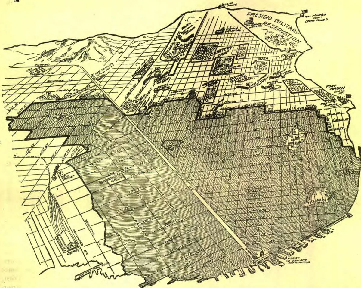
The burned district of San Francisco is shown within the heavy black lines, the general boundaries being the water…
The burned district of San Francisco is shown within the heavy black lines, the general boundaries being the water front from Brannan Street on the east to Jones Street on the north, thence along Jones to Chestnut, to Hyde, to Polk, to Filbert, to Van Ness Avenue, to Clay, to Franklin, to Sutter, to Van Ness Avenue, to Golden Gate Avenue, to Octavia, to Page, to Gough, to Market, to Dolores, to Twentieth, to Mission, to Eighteenth, to Howard, to Fifteenth, to Folsom, to Eleventh, to Townsend, to the water-front. Within the district which escaped the flames are shown the Red Cross hospitals, camps, and supply-stations at Fort Mason, the Presidio, Golden Gate Park, Duboce Park, Seventeenth and Castro, Twenty-fourth and Noe, Mission Park, Mission Dolores, Haight and Market, Jefferson Square, Cemetery Camp, Alta Plaza, and Lobos Square. This is approximate. The Post-office, Mint, and Appraisers' Building escaped.
From Signs of the Times, Vol. 32, No. 20., May 23, 1906