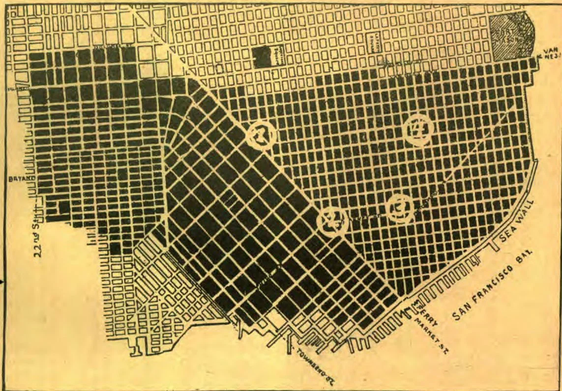
Map of the burned district, from the Ferry Building to Van Ness Avenue, and from Channel and Twenty-Second Streets to…
Map of the burned district, from the Ferry Building to Van Ness Avenue, and from Channel and Twenty-Second Streets to North Beach, seven square miles. 1. City Hall. 2. Call Building. 3. Chinatown. 4. Nob Hill.
From Signs of the Times, Vol. 32, No. 18., May 2, 1906